Gemini - PREGPS

Project Restoration & Enhancement: PRE-GPS

The Project Restoration & Enhancement – Gemini Positioning Survey (PRE-GPS) was conducted to support the future implementation of large-scale oyster restoration and other nature-enhancement measures within the Gemini Offshore Wind Farm (OWF). The study combined desk-based analyses and field surveys to improve understanding of seabed morphology, sediment composition, and seabed dynamics. 

To identify suitable locations for nature-enhancement projects within the Gemini OWF through the assessment of seabed morphology, sediment characteristics, and morphodynamics using available survey data, numerical modelling, ROV investigations, and sediment sampling.


Program: Nature Regeneration North Sea (NN)
2025 -2026

Project dates

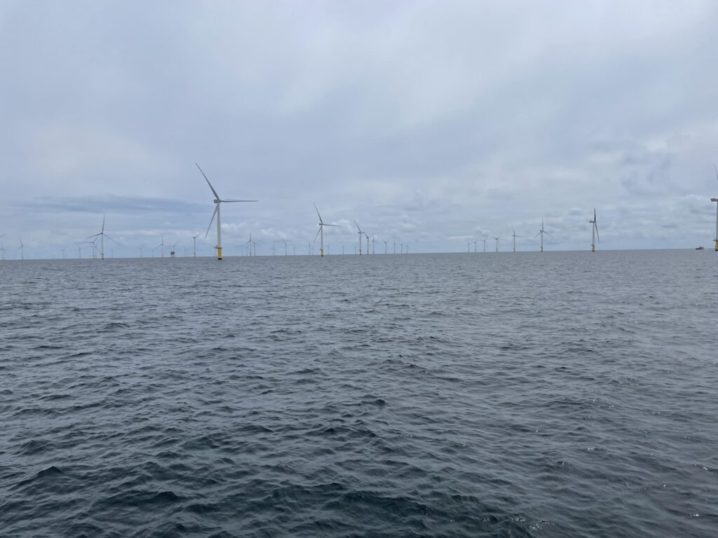
Gemini OWF

Location

Nature Regeneration North Sea, Seaward, Waterproof, The Rich North Sea

Project lead and partners

For long-term oyster restoriation project

Target species

Methods

The PRE-GPS project was carried out to support the selection of suitable locations for future nature-enhancing measures, including large-scale native oyster restoration, within the Gemini Offshore Wind Farm. The study combined historical data analysis, field surveys, sediment sampling and numerical modelling to assess seabed conditions and habitat suitability. Three candidate locations were selected based on differences in bathymetry, morphology, geological setting and ecological relevance: a shallow location near turbine W5 in the Buitengaats wind farm, a deeper location near turbine B6 in the ZeeEnergie wind farm, and the existing WINOR oyster restoration site.


To evaluate seabed morphology and dynamics, historical multibeam echosounder (MBES) surveys acquired between 2007 and 2025 were analysed. These datasets were used to assess long-term seabed stability, bedform migration and potential erosion or sedimentation patterns across the wind farm. Existing ROV imagery collected during the WINOR project in May and October 2024 was also reviewed to evaluate local seabed changes around oyster spat collector frames.


Additional field surveys were conducted in July 2025 using the Scout remotely operated vehicle (ROV) from Lobster Robotics. High-resolution seabed mapping was successfully completed at the W5 and B6 locations, generating detailed bathymetric maps and imagery of the seabed surface. Surveying of the WINOR site was planned but could not be completed due to adverse weather conditions.


To characterise seabed sediment composition, sediment samples were collected using a Van Veen grab sampler at four locations around the ZeeEnergie wind farm in October 2025. Laboratory analyses were carried out to determine grain-size distribution, mud content, wet bulk density and dry bulk density.


In addition, Delft3D-based sediment transport and morphological modelling was used to investigate seabed behaviour during storm conditions and to assess the likelihood of erosion or sedimentation. The combined results from seabed mapping, sediment analyses, historical surveys and numerical modelling were used to evaluate habitat suitability and refine site selection for future restoration and nature-enhancement initiatives in the Gemini Offshore Wind Farm.

Results

The PRE-GPS study improved understanding of seabed conditions in the Gemini Offshore Wind Farm and supported the identification of suitable locations for future nature-enhancing measures, including large-scale native oyster restoration. Analyses of historical multibeam echosounder (MBES) surveys, ROV imagery and sediment transport modelling showed that seabed dynamics are generally limited to small-scale ripples and megaripples. No evidence was found for large-scale erosion or sedimentation, indicating relatively stable seabed conditions that may be suitable for long-term restoration projects.


The field surveys revealed clear differences between locations. The shallow W5 site in the Buitengaats wind farm was characterized by small-scale sandy ripple fields, whereas the deeper B6 site in the ZeeEnergie wind farm displayed a more pockmarked seabed morphology, suggesting a stronger influence of benthic organisms on shaping the seabed surface.


Sediment analyses showed that three of the four sampled locations consisted almost entirely of sand (98–99%), while one location near turbine K8 contained approximately 42% mud. This indicates that sediment composition can vary substantially over relatively short distances and may be an important factor when selecting suitable restoration sites. Median grain sizes (D50) ranged between 191 and 289 μm.


The study concludes that the Gemini Offshore Wind Farm offers promising opportunities for future oyster restoration and other nature-enhancing measures. Additional large-scale sediment mapping is recommended to better understand the spatial extent of mud-rich areas and further refine restoration site selection.


Download full report:

Project Restoration & Enhancement – Gemini Positioning Survey (PRE-GPS)

Tips & Tricks

  • Combining historical bathymetric datasets (MBES), ROV surveys, sediment sampling and numerical modelling provides a robust basis for selecting suitable locations for nature-enhancement measures and restoration projects.
  • Seabed stability is an important prerequisite for large-scale oyster restoration. Assessing long-term seabed dynamics before implementation can help reduce the risk of restoration measures being affected by erosion or sedimentation.
  • Local sediment characteristics can vary considerably over relatively short distances. Sediment sampling should therefore be included in site-selection studies, even when regional seabed maps are available.
  • Field data remain essential. Historical datasets and modelling provide valuable insights, but high-resolution surveys and sediment samples are needed to understand local seabed conditions and habitat suitability.
  • Differences between relatively shallow and deeper locations may influence habitat characteristics and restoration potential. Comparing multiple site types can improve restoration design and increase the likelihood of success.
  • Early coordination with offshore wind farm operators and relevant authorities facilitates access, survey planning and sampling activities within operational wind farms.
  • Additional large-scale sediment mapping can help identify local mud-rich areas and improve the selection of suitable locations for oyster restoration and other nature-enhancement measures.

Let's talk

Would you like to know more about this project or get involved? Send an email to the project lead.

Frank@seaward.blue