Innovative marine ecological monitoring using Unmanned Underwater Vehicles (UUVs)

Monitoring is essential for understanding the effects of nature restoration and Nature-Inclusive Design measures in the North Sea. Traditional monitoring methods, such as diver inspections and vessel-based sampling, provide valuable information but can be limited by safety considerations, weather conditions and the ability to efficiently survey larger areas.


This project explored how Unmanned Underwater Vehicles (UUVs), including Remotely Operated Vehicles (ROVs) and Autonomous Underwater Vehicles (AUVs), can support ecological monitoring in the Dutch North Sea. Seven different UUV systems were tested under realistic field conditions at the Voordelta and Offshore Test Site (OTS), where optical, acoustic and environmental data were collected using a range of sensors and survey techniques. (See how it works)

The field trials showed that ROVs and AUVs each have distinct strengths. ROVs proved particularly suitable for close-range inspection of complex structures, such as artificial reefs, while AUVs were effective for larger-scale and repeatable habitat surveys. The project demonstrates that UUVs can improve the efficiency, safety and repeatability of ecological monitoring programmes and provide valuable guidance for selecting suitable monitoring technologies for future North Sea restoration projects.

The objective of the project was to evaluate the applicability of small ROVs and AUVs for ecological monitoring under realistic North Sea conditions. The assessment focused on operational performance, data quality, navigation, repeatability and suitability for different ecological monitoring applications.
Program: Nature Regeneration North Sea (NN)
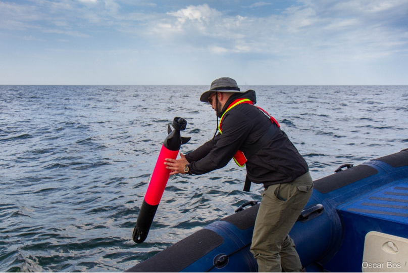
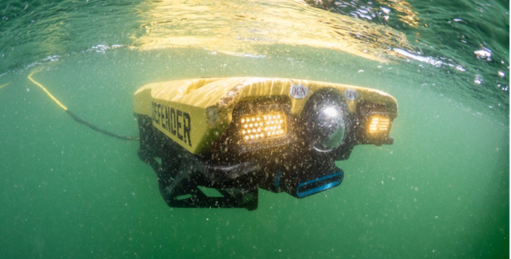
Image credit: Oscar Bos
June 2025 - August 2026

Project dates

Voordelta and Offshore Test Site (OTS)

Location

Wageningen Marine Research (Lead), TNO, The Rich North Sea, Seaward

Project lead and partners

Benthic communities 

Target species

Voordelta

The Voordelta was selected as a test location because it represents a shallow, dynamic and sediment-rich coastal environment containing biogenic reefs of European flat oysters, Pacific oysters and mussels. These habitat types are relevant for nature restoration and ecological monitoring programmes in the Dutch North Sea.


Several Unmanned Underwater Vehicle (UUV) systems were deployed under realistic field conditions to assess their suitability for ecological monitoring. During the field trials, optical, acoustic and environmental data were collected using cameras, sonar systems and environmental sensors. Data products included video imagery, photographs, photomosaics, sonar imagery and water-quality information.


The relatively shallow water depth and good visibility created favourable conditions for optical surveys. High-quality video footage and images made it possible to document reef structures and larger visible organisms. In addition, photo mosaics and georeferenced datasets provided detailed spatial information about habitat distribution and reef characteristics.


The field trials also demonstrated that monitoring performance depends strongly on environmental conditions and the selected survey technique. Some acoustic systems, such as Side-Scan Sonar, were less effective in the shallow-water conditions of the Voordelta, while optical systems performed particularly well when visibility, platform stability and survey altitude were optimal.


The Voordelta trials showed that UUVs can provide valuable information on habitat structure, reef development and visible marine life, and can be used as a safe and efficient complement to traditional monitoring methods.

OffshoreTestSite

The Offshore Test Site (OTS) was selected as a contrasting monitoring location to evaluate UUV performance under deeper offshore conditions. The site contains artificial reef structures that provide a more complex three-dimensional environment than the oyster and mussel reefs present in the Voordelta.


During the field trials, multiple UUV platforms were deployed to collect optical, acoustic and environmental data. Surveys included video imagery, photographs, sonar data, photomosaics and environmental measurements. The trials focused on assessing how different UUV systems perform around artificial reef structures and under offshore monitoring conditions.


The complex reef structures provided a useful test environment for close-range inspections. ROVs were particularly effective at surveying these structures because operators could adjust camera angles in real time and carefully navigate around obstacles. This allowed for detailed inspection of reef surfaces and larger visible organisms.


The offshore conditions also highlighted several limitations. Reduced visibility made species identification from optical imagery more difficult than at the Voordelta, increasing the value of acoustic sensors for habitat mapping. In addition, some AUVs were less suited for operating close to complex structures when obstacle avoidance capabilities were limited.


The Offshore Test Site trials demonstrated that different monitoring objectives require different technologies. ROVs are well suited for detailed inspections of artificial reefs, while AUVs can efficiently collect repeatable, georeferenced data over larger areas. Together, these systems provide valuable tools for monitoring habitat development and ecological changes in offshore environments.

Methods

Seven different Unmanned Underwater Vehicle (UUV) systems were tested under realistic field conditions at two contrasting monitoring locations in the Dutch North Sea: the Voordelta and the Offshore Test Site (OTS).


Both Remotely Operated Vehicles (ROVs) and Autonomous Underwater Vehicles (AUVs) were equipped with various combinations of optical, acoustic and environmental sensors. During the field trials, data were collected using video cameras, photographic systems, Forward-Looking Sonar (FLS), Side-Scan Sonar (SSS), Multibeam Echo Sounders (MBES), and water-quality sensors. Demonstrations of water and sediment sampling were also carried out.


The assessment focused on operational performance, manoeuvrability, navigation, georeferencing, data quality and suitability for ecological monitoring applications. The trials were designed as practical technology demonstrations under realistic North Sea conditions and were not intended as benchmark tests or rankings of the different UUV systems.


Results

The field trials demonstrated that Unmanned Underwater Vehicles (UUVs) can provide valuable ecological information under realistic North Sea conditions, but that the suitability of a system depends strongly on the monitoring objective.


Autonomous Underwater Vehicles (AUVs) performed particularly well for larger-scale habitat mapping and repeatable surveys. Their ability to follow predefined transects and collect georeferenced datasets makes them well suited for long-term monitoring programmes and spatial habitat assessments.


Remotely Operated Vehicles (ROVs) proved most effective for close-range inspection of complex three-dimensional structures, such as artificial reefs. Real-time operator control allowed detailed observations and flexible navigation around structures that are difficult to survey using autonomous systems.


The trials showed that optical systems can provide highly detailed ecological information when water visibility, platform stability and survey altitude are favourable. Under such conditions, video imagery, photographs, photomosaics and 3D reconstructions can be used to document habitat structure and visible marine life.


Environmental conditions strongly influenced data quality. Reduced visibility limited the ability to identify species from optical imagery, particularly at the Offshore Test Site. Under these conditions, acoustic systems such as Forward-Looking Sonar, Side-Scan Sonar and Multibeam Echo Sounders proved more robust and remained effective for habitat mapping and structural observations.


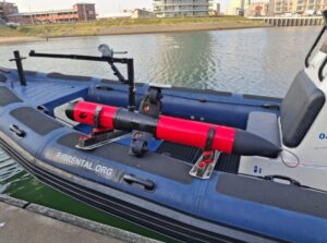
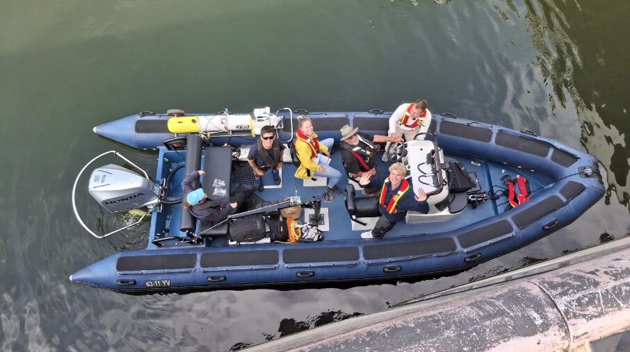
The project also highlighted several practical operational challenges. Deployment from small RHIBs required careful consideration of vessel movement, deck space, tether management, sunlight visibility on screens and current conditions. These factors affected both survey efficiency and data collection quality.


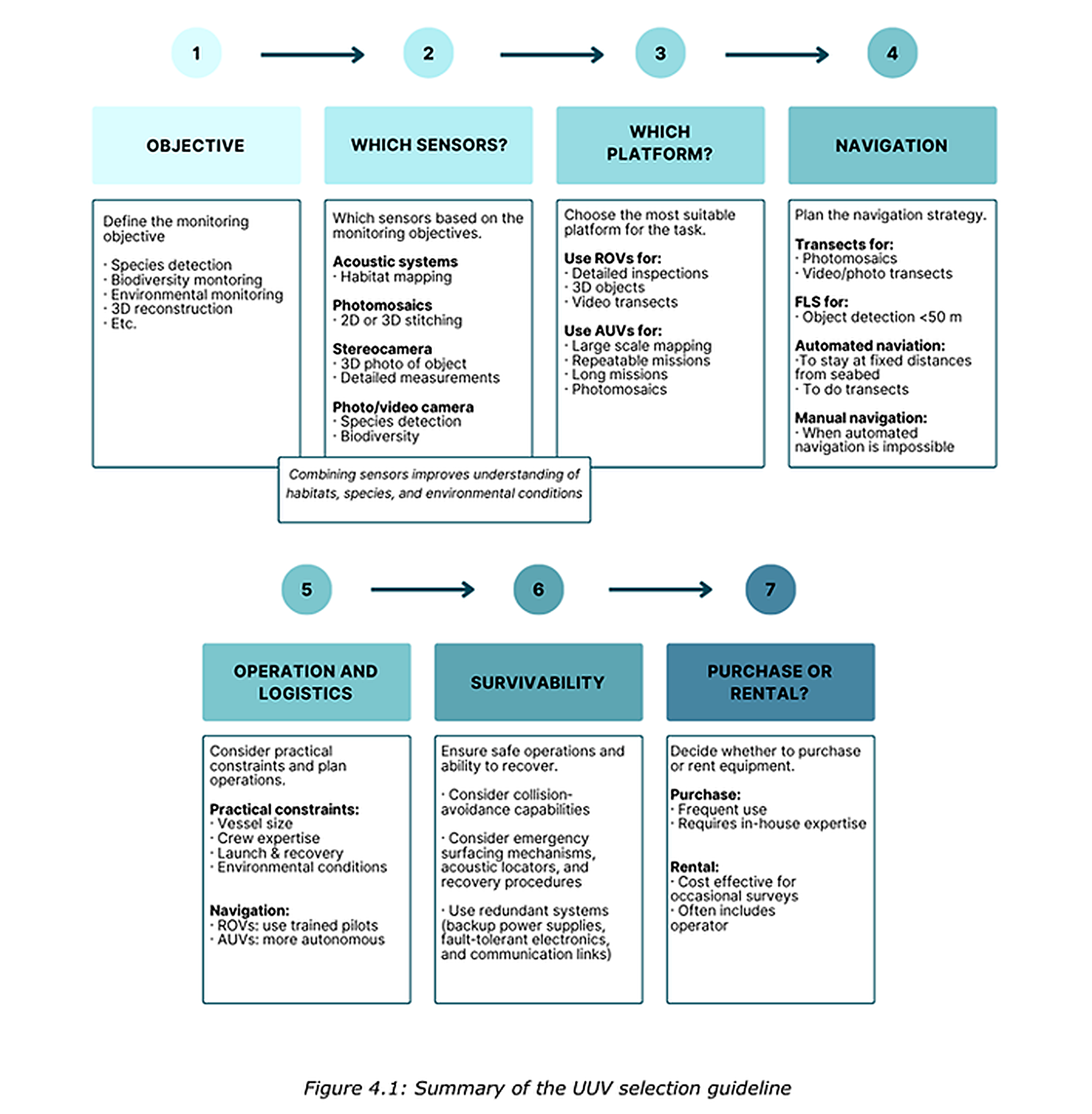
Overall, the trials demonstrated that no single UUV system is suitable for all monitoring tasks. The most effective monitoring approach depends on the monitoring objective, environmental conditions and data requirements. Selecting the appropriate combination of platform and sensors is therefore essential for obtaining reliable and repeatable ecological data.

Tips & Tricks


  • Start with the monitoring objective.
    Determine whether the goal is to identify species, map habitat structure, measure water quality, or inspect a specific object. The monitoring objective largely determines which UUV platform and sensor configuration are most suitable.
  • Match the platform to the task.
    Use an AUV for larger survey areas and repeatable transects, and an ROV for close-range inspection of complex three-dimensional structures such as reefs and underwater infrastructure.
  • Plan optical surveys carefully.
    High-quality imagery depends on good visibility, stable platform motion, a low survey altitude, and sufficient image overlap. These factors strongly influence the quality of photographs, video footage, photomosaics and 3D reconstructions.
  • Focus on consistency for long-term monitoring.
    Reliable monitoring requires more than accurate positioning. Consistent survey design, sensor settings, metadata collection, data quality and processing workflows are equally important for comparing results over time.
  • Work with the prevailing current.
    Whenever possible, plan transects parallel to the dominant current direction to improve vehicle stability and increase data consistency.
  • Combine methods when possible.
    UUVs provide valuable information on habitat structure and visible organisms, but they do not capture everything. Combining UUV surveys with targeted physical sampling can provide a more complete ecological assessment.


Interactive map (IQUA Sparus II AUV)

System specifications
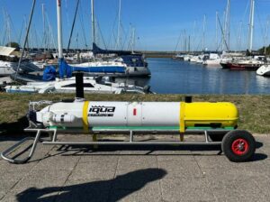
Tested system: Sparus II AUV
Platform type: AUV
Mass: 55 kg
Dimensions:
Length = 160 cm, Width = 46 cm, Height = 49 cm, Diameter = 23 cm
System abilities
Perception ability: MBES (Norbit WBMS, 400 kHz), FLS (Oculus M1200d, 1.2/2.1 MHz), Camera (FLIR blackfly, Fixed downward)
Autonomous ability: Waypoint following, Altitude control, Hovering mode, obstacle avoidance
Mission Evaluation
IQUA Robotics demonstrated the capabilities of the SPARUS II AUV at the offshore test site, successfully completing launch and recovery, autonomous waypoint following, and acquiring camera, FLS, and MBES data for mosaic generation and seabed mapping. The camera and FLS mosaics and the MBES map provide visual and acoustic documentation of the surveyed reef cubes. An operational limitation was observed: as the AUV maintained a safe standoff distance to avoid collisions, the mosaic quality remained high for the upper surfaces of the nature recovery blocks, but the lower segments appeared blurry due to the increased distance and limited visibility.
Marine Environment
Seabed data
Min depth (lat): 20.4 [m]
Max depth (lat): 21.9 [m]
Sediment type (folk): Sandy


Interactive map (Lobster Scout II AUV)

System specifications
Tested system: Scout II AUV
Platform type: AUV
Mass: 60 kg
Dimensions: Length = 200 cm, Diameter = 60 cm
System abilities
Perception ability: Camera (fixed downward)
Autonomous ability: Waypoint following
Mission Evaluation
Lobster Robotics demonstrated the capabilities of the Scout II AUV at the offshore test site, successfully capturing camera data near the Reefcube egg and the WERC‑dock reef cube, as well as conducting a seabed survey. Launch and recovery were successfully demonstrated from the RHIB. While the transects were executed, visibility was insufficient to acquire camera data of adequate quality for generating mosaics, with visibility being less than one meter. Although the AUV can operate at 0.5 m above the seabed, it lacks obstacle‑avoidance capability, preventing safe close‑range data acquisition near the targeted reef cubes.
Marine Environment
Seabed data
Min depth (lat): 20.4 [m]
Max depth (lat): 21.9 [m]
Sediment type (folk): Sandy


Innovative Monitoring

Discover how innovative underwater monitoring techniques are helping researchers better understand and protect North Sea ecosystems. Through testing and comparing advanced technologies, this project provides valuable insights for more effective, safe, and scalable marine nature restoration.

Let's talk

Would you like to know more about this project or get involved? Send an email to the project lead.

enzo.kingma@wur.nl